Borasu Pass Trek

Published: byVishwanath R,19 Feb, 2017
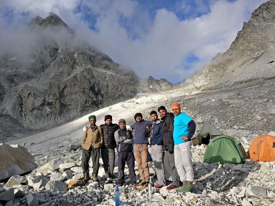
Borasu Pass is an 5200M+ pass that connects the Tons Valley in Uttarakhand with the Baspa Valley in Kinnaur District of Himachal Pradesh. We a group of intrepid trekkers decided to decided to cross the high altitude pass in September. So, along with a bunch of experienced porters and guide from taluka hired a vehicle from Dehradun to Sankri & walked from Sankri to Taluka for a couple of hours to reach GMVN guest house at Taluka in time for dinner.
First day, we continued onto to osla with lunch en-route at Ghangad. From Osla we walked beyond village and camped amidst the meadows. That night it poured "cats and dogs and its cousins".
We walked to Har Ki Dun and then along the true right of the Maninda Gad to a meadow 1-2 km before Maninda Taal. The Maninda Tal is formed at an area where the Maninda Gad spreads out on a flat land. Due to the constant drizzling and a near whiteout, we called an early halt and waited it out that day. We camped under a huge boulder which was a natural campsite (also used by the shepherds).
The next day, the weather had cleared up just enough to entice us into moving early. We self-guided ourselves with a gps, map and followed the lay of the land to camp in the glacial moraines beside a small glacial pond about 500M before Sauni Bhera (marked in map as Sorna Vir). We had to camp here as it was starting to drizzle.
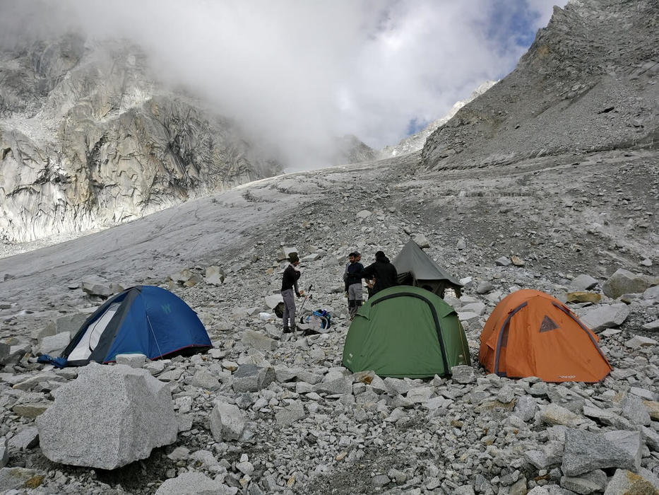
On 4th day, with the weather slightly improving, we headed to Sauni Bhera, which we reached in about 30-45 mins. Post that due to a minor navigational error we spent an hour climbing up and down a side ridge before returning Sauna Bhera campsite. By this time the visibility was very low. We again ventured along, what I thought to be the right route. After about 30-45 mins climb, beside a nala, based on my gps reading I felt we were about 100 M left of where the actual trail is supposed to be. So we recces once again and soon we found the right trail. We climbed the trail, till what appeared to be the high camp at 4750 M, amidst the boulder zone. There is a clear view of the ice-wall below the pass from this camp.
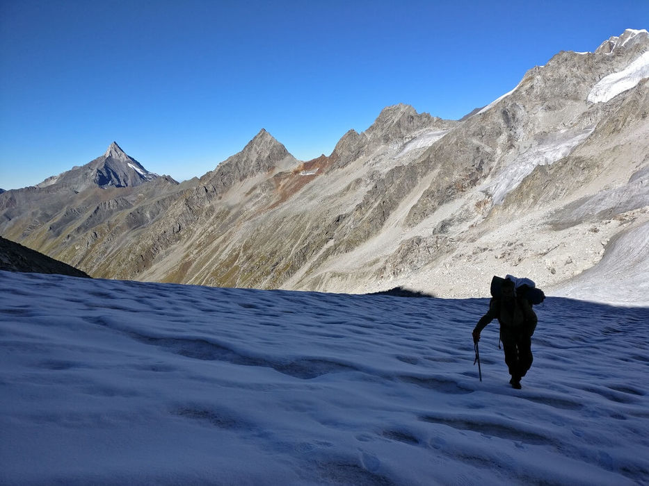
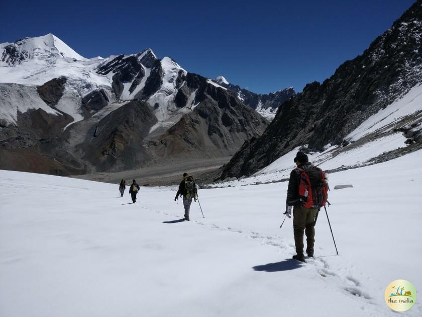
We were lucky on the morning as it was a bright sunny day. The route to the pass was clearly visible. We dismantled the tent quickly and trudged up to the 5200 mts Borasu pass in just 3 hrs. The last 50M-100M climb was a scramble on boulders.The views from the pass, looking back into the valley along the way we came, was spectacular. So, were the views of the glacier on the other side of the valley. As per the map though the actual pass was further to the NW, along the same ridge, by about 500-600M, at nearly the same elevation. It was a sharp, steep descent on boulders for about 150M or so. Then we had to cross a crevassed snowfield. The crevasses were mostly open and we could avoid most. However, we fell into a crevasse each about waist deep on separate occasions. On both occasions we could extricate ourselves. We suspected the route to be on our left but the snow/ ice-field seemed treacherous, so we got down a boulder zone on our right (as we descend) right into the glacier. This was definitely not a path that was used. It was a tedious walk for the next 2 hours on the glacier. We had come to the left side of the glacier and we soon realized that we had to be on the other side of the glacier.
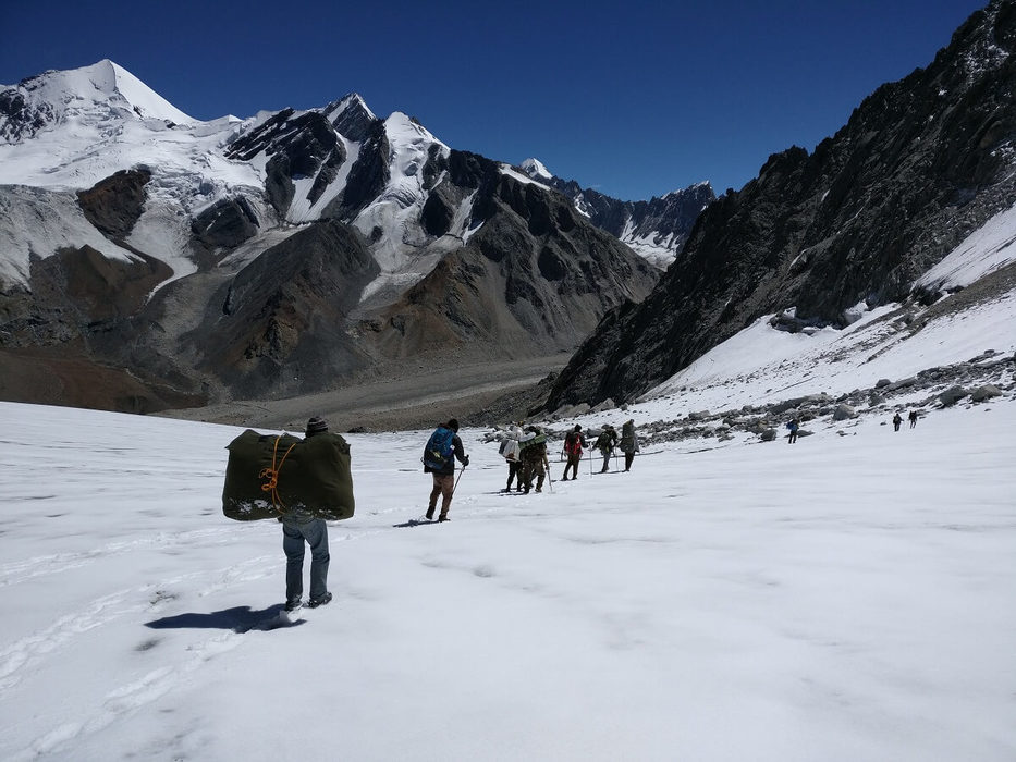
However, the glacier was too wide and so we decided to go further down till we somewhat reached towards the snout, where the glacier narrowed to find an opportune place to cross it. Luckily, near a glacial lake, closer to the snout we found a way across the glacier. There was an ice cave near the glacial lake too. From there on we walked till we reached a patch of green grass, which marked the beginning of the Jorya Garang (the stream which originated from this glacier).
Luckily, we had crossed over as the stream was in such full flow that it would not have been possible to cross it downstream. There was a side stream ("khad") which was in full flow & as it was late (around 6 p.m) we decided to camp here and cross the side stream the next morning, when the water levels would be less. All in all it was a tough, arduous long day's trek - made tougher by the fact that we did not have a guide and a 20+ kg backpack to boot. The weather on this side of the pass was much better.
On 6th day, we walked along the Jorya Garang and reached the ITBP outpost at Ranikanda, where we had tea and a bit of a rest. Then we walked along the road, beyond the ITBP check post at Nagasti to reach Chitkul for a late afternoon lunch.
All in all, it was one of the best trek I did and really enjoyed with all amazing group member.
Image credit - Summitersadventures.com
Customize your dream vacation with our best India tour packages.
0(No Review)
8D/7N
Memorable Dehradun Nainital Corbett Tour Package (7 Nights-8 Days)
![]() Uttarakhand, India
Uttarakhand, India
₹ 45,000
Amazing write up. There is one more pass on Kinnaur - Garhwal Himalayan range , Lamkhaga pass trek. Link to the travelogue is following https://raachotrekkers.com/lamkhaga-pass-trek-in-the-footsteps-of-marco-pallis-raacho-trekkers/